Sauropterygia
Sauropterygia is an extinct clade of diverse, generally marine reptiles that developed from terrestrial ancestors soon after the end-Permian extinction and flourished during the Triassic before all except for the Plesiosauria became extinct at the end of that period. The plesiosaurs would continue to diversify until the end of the Mesozoic, when they became extinct as part of the end-Cretaceous mass extinction. Other than being diapsids, their affinities to other reptiles have long been contentious. Sometimes suggested to be closely related to turtles, other proposals have considered them most closely related to Lepidosauromorpha or Archosauromorpha, and/or the marine reptile groups Thalattosauria and Ichthyosauromorpha.

Ghedoghedo · CC BY-SA 3.0 · via Wikipedia/Commons. May be a photograph of a specimen, or an artist’s reconstruction — an interpretation of a skeleton, since colour and soft tissue are almost never preserved.
On record
Recorded, not inferred- Sits inside
- DiapsidaPBDB
- Motility
- actively mobilePBDB, for Osteichthyes
- Environment
- marinePBDB
Time the record covers
At least 174 million years on record.
The record covers at least 247 Mya to 72.2 Mya. No occurrence read is dated outside 251.902 Mya to 56 Mya.
1,582 occurrences of Sauropterygia on record, most of them in the Late Cretaceous. Bar height is expected occurrences, not a count: each fossil is spread across the span it is dated to, so a tall narrow bar means tight dating and a low wide one means loose.
When
1,582 occurrences- Early Triassicunder 1%
- Middle Triassic22%
- Late Triassic4%
- Early Jurassic7%
- Middle Jurassic6%
- Late Jurassic13%
- Early Cretaceous10%
- Late Cretaceous37%
- Paleoceneunder 1%
These are dates about fossils, not the animal: the record can only begin after it arose and end before it died out, so either end may reach further. Shares are expected occurrences: a fossil dated to a span is counted partly in each period it straddles. More on what this infers.
Found in
327 formations
- Kimmeridge Clay Formation · Ancholme Group85
- Oxford Clay Formation · Ancholme Group55
- Conway Formation · Eyre Group37
- López de Bertodano Formation24
- Niobrara Formation · Colorado Group21
- Allen Formation · Malargüe Group20
Loading coastlines…
The named rock units Sauropterygia has been recovered from, largest first. Drawn where the rock is now, not where it formed. 303 further formations hold fewer occurrences each and are not listed. 367 occurrences have no formation on record, which is common for older literature.
Sauropterygia and its relatives
Late CretaceousWhere Sauropterygia and its relatives were recorded in the Late Cretaceous.
Found in the same rock
1,438 taxa- Plesiosauria62 sites
- Elasmosauridae35 sites
- Theropoda18 sites
- Mosasauridae17 sites
- Teleostei15 sites
- Serpianosaurus mirigiolensis12 sites
- Hybodus11 sites
- Pliosauridae11 sites
- Testudines11 sites
- Inoceramus10 sites
- Polycotylidae10 sites
- Enchodus9 sites
- Ichthyosauria9 sites
- Nothosaurus9 sites
- Osteichthyes9 sites
- Pterosauria9 sites
- Cretalamna appendiculata8 sites
- Crocodylia8 sites
- Meristodonoides montanensis8 sites
- Myledaphus bipartitus8 sites
- Ostrea8 sites
- Reptilia8 sites
- Astarte7 sites
- Bivalvia7 sites
The Paleobiology Database records 1,128 sites for Sauropterygia, and this reads 240 of them. The number is how many of those sites it was catalogued from too. The 24 sharing the most are listed.
This is not a list of everything alive at the time. It is only what has come out of the same ground as this animal and been written down.
Entered from
702 references- A revision of the genus Nothosaurus (Reptilia: Sauropterygia) from the Germanic Triassic, with comments on the status of Conchiosaurus clavatus56
- Lydekker, 188946
- The Mesozoic reptiles of Dorset. Part two33
- The genus Placodus: systematics, morphology, paleobiogeography, and paleobiology24
- Late Cretaceous marine reptiles of New Zealand22
- Reptiles from the Senonian (U Cret) of Scania (S Sweden)20
- On the fossil Reptilia of New Zealand17
- A stratigraphic and taxonomic review of plesiosaurs from the old "Fort Benton Group" of central Kansas: a new assessment of old records15
- Osteology of Simosaurus gaillardoti and the relationships of stem-group Sauropterygia14
- The end of the dinosaur era in Patagonia (NatGeo Project)13
- Turonian marine amniotes from the Bohemian Cretaceous Basin, Czech Republic13
- A new pachypleurosaur (Reptilia: Sauropterygia) from the Middle Triassic of Monte San Giorgio, Switzerland13
Each of the 1,582 occurrences read was entered from one of these publications, ordered by how many each accounts for. This is not a search for papers mentioning the name. 690 further references are not listed. Entries link to doi.org where the Paleobiology Database holds an identifier, and to its own record where it does not. Relayed as the Paleobiology Database holds them, not checked against what they resolve to.
Media and terms
Media content2

Picture of Sauropterygia
- Source
- Wikipedia/Commons
- Credit
- Ghedoghedo
- Licence
- CC BY-SA 3.0
- Commercial use
- the licence allows it
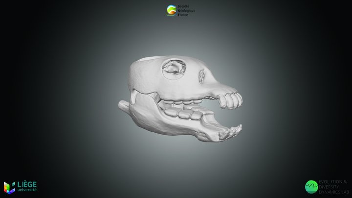
3D model
- Source
- Sketchfab
- Licence
- CC Attribution-NonCommercial-ShareAlike
- Commercial use
- the licence does not allow it
Smithsonian Open Access and MorphoSource were not reached for this taxon, so this list is what the others held rather than everything there is.
The description on this site
- Licence
- CC BY-SA 4.0
This is what the site found, which is not the same as what exists.
Keep going
What may have been alongside itDiapsida through timeFormations of the Late CretaceousThe world it lived on
Occurrence data from the Paleobiology Database, CC BY 4.0. (Owen 1859)