Rhynchonellata
The Rhynchonellata is a class of Lower Cambrian to Recent articulate brachiopods that combines orders from within the Rhynchonelliformea with well developed pedicle attachment. Shell forms vary from those with wide hinge lines to beaked forms with virtually no hinge line and from generally smooth to strongly plicate. Most all are biconvex. Lophophores vary and include both looped and spiraled forms. Although morphologically distinct, included orders follow a consistent phylogenetic sequence.

Wilson44691 · CC BY-SA 3.0 · via Wikipedia/Commons. May be a photograph of a specimen, or an artist’s reconstruction — an interpretation of a skeleton, since colour and soft tissue are almost never preserved.
On record
Recorded, not inferred- Sits inside
- RhynchonelliformeaPBDB
- Diet
- suspension feederPBDB, for Brachiopoda
- Life habit
- low-level epifaunalPBDB, for Brachiopoda
- Motility
- stationary, attachedPBDB, for Brachiopoda
- Vision
- blindPBDB
- Environment
- marinePBDB, for Lophophorata
Time the record covers
At least 471 million years on record.
The record covers at least 509.7 Mya to 37.71 Mya. No occurrence read is dated outside 538.8 Mya to 33.9 Mya.
12,000+ occurrences of Rhynchonellata on record. The Paleobiology Database records this as a living group, and the chart stops with its fossils rather than at the present. Bar height is expected occurrences, not a count: each fossil is spread across the span it is dated to, so a tall narrow bar means tight dating and a low wide one means loose.
When
12,000 occurrences read- Cambrianunder 1%
- Ordovician19%
- Silurian18%
- Devonian24%
- Carboniferous28%
- Permianunder 1%
- Early Jurassicunder 1%
- Middle Jurassicunder 1%
- Late Jurassic1%
- Early Cretaceous3%
- Late Cretaceous2%
- Paleocene2%
- Eoceneunder 1%
These are dates about fossils, not the animal: the record can only begin after it arose and end before it died out, so either end may reach further. Shares are expected occurrences: a fossil dated to a span is counted partly in each period it straddles. The read hit its cap, so every figure above is a floor and the shares are of the occurrences read. More on what this infers.
Found in
at least 556 formations
- Bangor Limestone Formation292
- Three Forks Shale Formation264
- Waterways Formation216
- Denay Limestone Formation168
- Cherokee Shale Formation164
- Graham Formation159
Loading coastlines…
The named rock units Rhynchonellata has been recovered from, largest first. Drawn where the rock is now, not where it formed. The read hit its cap, so each count is a floor. 532 further formations hold fewer occurrences each and are not listed. 2,432 occurrences have no formation on record, which is common for older literature.
Found in the same rock
1,572 taxa- Crinoidea105 sites
- Crurithyris71 sites
- Brachiopoda65 sites
- Rhombopora60 sites
- Isotelus40 sites
- Gastropoda38 sites
- Hustedia35 sites
- Punctospirifer35 sites
- Rafinesquina34 sites
- Flexicalymene32 sites
- Hallopora31 sites
- Chonetinella30 sites
- Bryozoa29 sites
- Leptaena29 sites
- Zygospira29 sites
- Strophomena28 sites
- Bivalvia27 sites
- Composita27 sites
- Modiolopsis27 sites
- Nuculites27 sites
- Sowerbyella27 sites
- Ctenodonta26 sites
- Lingula26 sites
- Ambonychia25 sites
The Paleobiology Database records at least 439 sites for Rhynchonellata, and this reads 240 of them. The number is how many of those sites it was catalogued from too. The 24 sharing the most are listed.
This is not a list of everything alive at the time. It is only what has come out of the same ground as this animal and been written down.
Entered from
at least 386 references- Early Llandovery brachiopods of Wales848
- End-Cretaceous brachiopod extinctions in the chalk of Denmark316
- The Paleontology and Paleoecology of the Lower Bangor Limestone (Chesterian, Mississippian)in northwestern Alabama288
- Devonian sections in Guangxi from which pelecypods were collected263
- Stratigraphic and Paleontologic Studies of the Pennsylvanian and Permian Rocks in North-Central Texas251
- T.D. Olszewski''s Ph.D. - Penn State University241
- Geology of the Three Forks Quadrangle, Montana233
- Paleoecology and taphonomy of faunal assemblages in gray "core" (offshore) shales in Midcontinent Pennsylvanian cyclothems228
- Stratigraphy and Paleontology of the lowermost Upper Devonian Slave Point Formation on Lake Claire and the Lower Upper Devonian Waterways Formation on Birch River, NW Alberta225
- Biofacies Replacement in a Sequence Stratigraphic Framework: Middle and Upper Ordovician of the Nashville Dome, Tennessee, USA214
- Pennsylvanian Invertebrate Faunas of Southeastern Kansas191
- Devonian Transgressive-Regressive Cycles and Biostratigraphy, Northern Antelope Range, Nevada: Establishment of Reference Horizons for Global Cycles179
Each of the 12,000 occurrences read was entered from one of these publications, ordered by how many each accounts for. This is not a search for papers mentioning the name. That read hit its cap, so each count is a floor. 374 further references are not listed. Entries link to doi.org where the Paleobiology Database holds an identifier, and to its own record where it does not. Relayed as the Paleobiology Database holds them, not checked against what they resolve to.
Media and terms
Media content2

Picture of Rhynchonellata
- Source
- Wikipedia/Commons
- Credit
- Wilson44691
- Licence
- CC BY-SA 3.0
- Commercial use
- the licence allows it
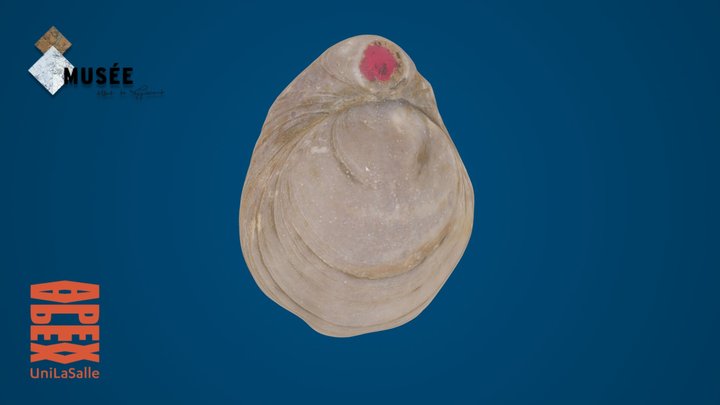
3D model
- Source
- Sketchfab
- Credit
- APEX UniLaSalle
- Licence
- CC Attribution
- Commercial use
- cannot be read from the licence given — check the record
Smithsonian Open Access and MorphoSource were not reached for this taxon, so this list is what the others held rather than everything there is.
The description on this site
- Licence
- CC BY-SA 4.0
This is what the site found, which is not the same as what exists.
Keep going
What may have been alongside itRhynchonelliformea through timeThe world it lived on
Occurrence data from the Paleobiology Database, CC BY 4.0. Williams et al. 1996