Nassariidae
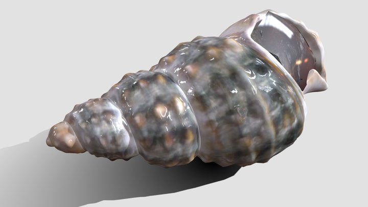
The Nassariidae, Nassa mud snails (US), or dog whelks (UK) are a taxonomic family of small to medium-sized snails, mostly marine gastropod mollusks in the clade Neogastropoda. These snails have rounded shells with a high spire, an oval aperture, and a siphonal notch. This family of snails is found worldwide.

Steve Lonhart (SIMoN / MBNMS) · Public Domain · via Wikipedia/Commons. May be a photograph of a specimen, or an artist’s reconstruction — an interpretation of a skeleton, since colour and soft tissue are almost never preserved.
On record
Recorded, not inferred- Sits inside
- BuccinoideaPBDB
- Diet
- carnivorePBDB
- Life habit
- low-level epifaunalPBDB
- Motility
- slow-movingPBDB
- Vision
- limitedPBDB, for Gastropoda
Time the record covers
At least 241 million years on record.
The record covers at least 241.464 Mya to 11.7 ka. No occurrence read is dated outside 247 Mya to 0 Mya.
3,823 occurrences of Nassariidae on record, most of them in the Miocene. The Paleobiology Database records this as a living group. Bar height is expected occurrences, not a count: each fossil is spread across the span it is dated to, so a tall narrow bar means tight dating and a low wide one means loose.
When
3,823 occurrences- Middle Triassicunder 1%
- Late Triassicunder 1%
- Late Jurassicunder 1%
- Early Cretaceousunder 1%
- Late Cretaceousunder 1%
- Paleocene2%
- Eocene10%
- Oligocene4%
- Miocene34%
- Pliocene20%
- Pleistocene27%
- Holocene2%
These are dates about fossils, not the animal: the record can only begin after it arose and end before it died out, so either end may reach further. Shares are expected occurrences: a fossil dated to a span is counted partly in each period it straddles. More on what this infers.
Found in
415 formations
- Gatun Formation167
- Careaga Sandstone Formation87
- Gurabo Formation79
- Palos Verdes Sand Formation76
- Pico Formation54
- Shoal River Formation · Alum Bluff Group51
Loading coastlines…
The named rock units Nassariidae has been recovered from, largest first. Drawn where the rock is now, not where it formed. 391 further formations hold fewer occurrences each and are not listed. 1,049 occurrences have no formation on record, which is common for older literature.
Nassariidae and its relatives
MioceneWhere Nassariidae and its relatives were recorded in the Miocene.
Found in the same rock
3,109 taxa- Turritella43 sites
- Parvilucina41 sites
- Anadara39 sites
- Cylichna38 sites
- Glycymeris38 sites
- Polinices37 sites
- Chlamys34 sites
- Dentalium33 sites
- Lucina33 sites
- Nuculana33 sites
- Acteocina31 sites
- Nucula30 sites
- Calyptraea29 sites
- Architectonica28 sites
- Tectonatica28 sites
- Bittium27 sites
- Ostrea27 sites
- Cancellaria26 sites
- Corbula26 sites
- Odostomia26 sites
- Ctena25 sites
- Nassarius (Uzita)25 sites
- Granulolabium plicatum24 sites
- Fusus23 sites
The Paleobiology Database records at least 1,036 sites for Nassariidae, and this reads 240 of them. Of that, one read hit the database's own return limit, so every count below is a floor rather than a total. The number is how many of those sites it was catalogued from too. The 24 sharing the most are listed.
This is not a list of everything alive at the time. It is only what has come out of the same ground as this animal and been written down.
Entered from
515 references- Die Fauna des marinen Miozäns von Kevelaer (Niederrhein)155
- Unpublished census data from Atlantic coastal plain and circum-Caribbean Neogene assemblages and taxonomic opinions140
- Unpublished notes on Caribbean collection of the Naturhistorisches Museum Basel114
- Geology and paleontology of canal zone and adjoing parts of Panama: Description of Tertiary mollusks (gastropods: Columbellidae to Volutidae).112
- The Molluscan Fauna of the Alum Bluff Group of Florida108
- Geology and paleontology of the Santa Maria District California102
- Studies on the marine Pleistocene: Part II. The marine Pleistocene mollusks of eastern North America90
- Resilience of marine invertebrate communities during the early Cenozoic hyperthermals84
- A paleobiotic survey of Caribbean faunas from the Neogene of the Isthmus of Panama83
- The Early Pliocene Gastropoda (Mollusca) of Estepona, Southern Spain. Part 8: Nassariidae77
- Miocene Gastropods and Biostratigraphy of the Kern River Area, California71
- Lower to Middle Miocene Mollusc assemblages from the Torino Hills (NW Italy): Synthesis of new data and chronostratigraphical arrangement61
Each of the 3,823 occurrences read was entered from one of these publications, ordered by how many each accounts for. This is not a search for papers mentioning the name. 503 further references are not listed. Entries link to doi.org where the Paleobiology Database holds an identifier, and to its own record where it does not. Relayed as the Paleobiology Database holds them, not checked against what they resolve to.
Media and terms
Media content2

Picture of Nassariidae
- Source
- Wikipedia/Commons
- Credit
- Steve Lonhart (SIMoN / MBNMS)
- Licence
- Public Domain
- Commercial use
- the licence allows it
Smithsonian Open Access was not reached for this taxon, so this list is what the others held rather than everything there is.
The description on this site
- Source
- Wikipedia, “Nassariidae”
- Licence
- CC BY-SA 4.0
This is what the site found, which is not the same as what exists.
Keep going
What may have been alongside itBuccinoidea through timeFormations of the MioceneThe world it lived on
Occurrence data from the Paleobiology Database, CC BY 4.0. Iredale 1916