Rugosa

The Rugosa are an extinct class of solitary or colonial corals that were abundant in Middle Ordovician to Late Permian seas.

Rugosa

Ernst Haeckel · Public Domain · via Wikipedia/Commons. May be a photograph of a specimen, or an artist’s reconstruction — an interpretation of a skeleton, since colour and soft tissue are almost never preserved.

On record

Recorded, not inferred
Also called
horn coralPBDB
Sits inside
HexacoralliaPBDB
Diet
suspension feederPBDB
Life habit
epifaunalPBDB
Motility
stationary, attachedPBDB
Vision
blindPBDB, for Anthozoa
Environment
marinePBDB

Time the record covers

At least 217 million years on record.

The record covers at least 471.3 Mya to 254.14 Mya. No occurrence read is dated outside 488.9 Mya to 251.902 Mya.

Cambrian — about 0 of 12000 occurrencesOrdovician — about 948 of 12000 occurrencesOrdovicianSilurian — about 1851 of 12000 occurrencesSilurianDevonian — about 5166 of 12000 occurrencesDevonianCarboniferous — about 2617 of 12000 occurrencesCarboniferousPermian — about 1418 of 12000 occurrencesPermianEarly Triassic — about 0 of 12000 occurrences494–485 Mya — about 0.6 occurrences485–477 Mya — about 2 occurrences477–469 Mya — about 4 occurrences469–461 Mya — about 10 occurrences461–453 Mya — about 151 occurrences453–444 Mya — about 686 occurrences444–436 Mya — about 639 occurrences436–428 Mya — about 762 occurrences428–420 Mya — about 542 occurrences420–411 Mya — about 624 occurrences411–403 Mya — about 354 occurrences403–395 Mya — about 319 occurrences395–387 Mya — about 1221 occurrences387–379 Mya — about 1740 occurrences379–370 Mya — about 794 occurrences370–362 Mya — about 76 occurrences362–354 Mya — about 169 occurrences354–346 Mya — about 363 occurrences346–338 Mya — about 795 occurrences338–329 Mya — about 681 occurrences329–321 Mya — about 192 occurrences321–313 Mya — about 75 occurrences313–305 Mya — about 214 occurrences305–296 Mya — about 259 occurrences296–288 Mya — about 257 occurrences288–280 Mya — about 278 occurrences280–272 Mya — about 313 occurrences272–264 Mya — about 287 occurrences264–255 Mya — about 125 occurrences255–247 Mya — about 68 occurrences471.3 Mya254.14 Mya494 Mya247 Mya

12,000+ occurrences of Rugosa on record. The Paleobiology Database records this as a living group, and the chart stops with its fossils rather than at the present. Bar height is expected occurrences, not a count: each fossil is spread across the span it is dated to, so a tall narrow bar means tight dating and a low wide one means loose.

When

12,000 occurrences read

These are dates about fossils, not the animal: the record can only begin after it arose and end before it died out, so either end may reach further. Shares are expected occurrences: a fossil dated to a span is counted partly in each period it straddles. The read hit its cap, so every figure above is a floor and the shares are of the occurrences read. More on what this infers.

Found in

at least 1118 formations

Onondaga — 40.60°N, 77.57°WOnondaga — 43.01°N, 78.01°WOnondaga — 42.95°N, 76.17°WOnondaga — 42.92°N, 78.25°WOnondaga — 42.78°N, 74.33°WOnondaga — 42.70°N, 74.92°WOnondaga — 42.96°N, 78.74°WOnondaga — 42.65°N, 74.08°WOnondaga — 42.00°N, 74.00°WOnondaga — 43.00°N, 75.00°WOnondaga — 43.00°N, 76.00°WOnondaga — 43.00°N, 74.67°WQixia — 23.71°N, 109.23°EQixia — 26.10°N, 106.82°EQixia — 25.99°N, 106.08°EQixia — 25.75°N, 106.10°EQixia — 27.92°N, 106.71°EQixia — 25.41°N, 106.56°EQixia — 26.25°N, 107.55°EQixia — 26.46°N, 105.06°EQixia — 25.91°N, 106.57°EQixia — 26.09°N, 106.57°EQixia — 25.40°N, 107.90°EQixia — 27.70°N, 106.93°EQixia — 26.07°N, 107.47°EQixia — 26.54°N, 106.04°EQixia — 27.41°N, 107.04°EQixia — 26.63°N, 106.85°EQixia — 27.29°N, 107.27°EQixia — 26.86°N, 108.94°EQixia — 26.67°N, 104.67°EQixia — 26.80°N, 105.27°EQixia — 28.60°N, 108.50°EQixia — 25.10°N, 106.40°EQixia — 26.71°N, 107.04°EQixia — 27.50°N, 108.25°EQixia — 28.34°N, 106.21°EQixia — 32.46°N, 106.90°EQixia — 29.41°N, 103.55°EQixia — 26.90°N, 104.30°EQixia — 29.58°N, 110.11°EQixia — 30.27°N, 117.98°EQixia — 31.63°N, 117.83°EQixia — 27.65°N, 114.04°EQixia — 27.23°N, 114.63°EQixia — 30.91°N, 117.82°EQixia — 32.15°N, 118.96°EQixia — 29.51°N, 115.26°EQixia — 32.08°N, 119.03°EQixia — 31.76°N, 118.14°EQixia — 31.48°N, 117.87°EQixia — 27.75°N, 114.95°EQixia — 31.10°N, 118.20°EQixia — 30.39°N, 120.00°EQixia — 31.45°N, 117.85°EQixia — 29.92°N, 119.54°EQixia — 30.00°N, 116.67°EQixia — 32.15°N, 118.95°EQixia — 30.85°N, 118.00°EQixia — 30.95°N, 117.80°EQixia — 30.65°N, 118.45°EQixia — 29.67°N, 115.66°EQixia — 31.95°N, 118.85°EQixia — 31.69°N, 119.02°EQixia — 31.12°N, 120.27°EQixia — 31.63°N, 117.96°EQixia — 30.81°N, 118.02°EQixia — 30.15°N, 116.10°EQixia — 27.17°N, 111.96°ELudlowville — 42.76°N, 78.65°WLudlowville — 42.78°N, 78.79°WLudlowville — 42.86°N, 77.76°WLudlowville — 42.87°N, 77.88°WLudlowville — 42.83°N, 77.81°WLudlowville — 42.88°N, 78.57°WLudlowville — 42.96°N, 78.13°WLudlowville — 42.80°N, 77.27°WLudlowville — 42.78°N, 76.99°WLudlowville — 42.86°N, 76.35°WLudlowville — 42.93°N, 76.22°WLudlowville — 42.95°N, 76.02°WLudlowville — 42.93°N, 76.00°WLudlowville — 42.85°N, 78.37°WLudlowville — 42.90°N, 78.77°WLudlowville — 42.77°N, 76.71°WLudlowville — 42.73°N, 76.71°WLudlowville — 42.89°N, 76.75°WLudlowville — 42.76°N, 75.54°WLudlowville — 42.76°N, 76.47°WLudlowville — 42.74°N, 75.54°WPortilla — 42.85°N, 1.84°EPortilla — 42.83°N, 5.65°WPortilla — 42.88°N, 5.12°EPortilla — 42.82°N, 5.22°EPortilla — 42.83°N, 1.57°EPortilla — 43.00°N, 6.17°WPortilla — 42.83°N, 5.10°WPortilla — 42.87°N, 5.66°WPortilla — 42.87°N, 5.85°WPortilla — 42.84°N, 5.50°WPortilla — 42.87°N, 5.45°WPortilla — 42.83°N, 5.30°WHigh Tor Limestone — 51.63°N, 3.97°WHigh Tor Limestone — 51.50°N, 3.00°WBlack Rock Limestone — 51.57°N, 4.33°WBlack Rock Limestone — 51.33°N, 2.74°WSkinner Ranch — 30.26°N, 103.34°WSkinner Ranch — 30.36°N, 103.21°WSkinner Ranch — 30.34°N, 103.22°WSkinner Ranch — 30.25°N, 103.35°WSkinner Ranch — 30.21°N, 103.42°WSkinner Ranch — 30.25°N, 103.36°WBeaverfoot — 50.71°N, 115.38°WBeaverfoot — 50.50°N, 115.92°WBeaverfoot — 50.75°N, 115.50°WBeaverfoot — 50.03°N, 115.51°WBeaverfoot — 52.00°N, 116.75°WBeaverfoot — 50.67°N, 115.35°WBeaverfoot — 50.45°N, 115.77°WBeaverfoot — 51.17°N, 116.73°WBeaverfoot — 50.38°N, 115.80°WBeaverfoot — 50.88°N, 116.22°WBeaverfoot — 50.00°N, 116.40°WBeaverfoot — 51.20°N, 116.82°WBeaverfoot — 50.18°N, 115.36°WBeaverfoot — 50.47°N, 115.25°WBeaverfoot — 50.59°N, 115.30°WBeaverfoot — 51.68°N, 116.22°WBeaverfoot — 52.13°N, 116.98°WBeaverfoot — 49.83°N, 119.83°WSilica — 41.72°N, 83.72°WSilica — 42.13°N, 83.60°WSilica — 41.12°N, 84.85°WKhandyg — 62.20°N, 138.15°EKhandyg — 63.40°N, 136.68°EKhandyg — 60.15°N, 137.10°EKhandyg — 63.52°N, 136.60°EKhandyg — 62.93°N, 138.10°EKhandyg — 62.85°N, 138.15°EJeffersonville Limestone — 38.50°N, 85.75°WJeffersonville Limestone — 38.25°N, 85.77°WKakisa — 61.00°N, 120.00°WKakisa — 57.00°N, 124.00°WKakisa — 56.28°N, 123.39°WKakisa — 61.14°N, 119.84°WKakisa — 61.12°N, 119.39°WKakisa — 61.13°N, 119.00°WKakisa — 60.89°N, 117.81°WKakisa — 60.57°N, 117.13°WKakisa — 60.97°N, 118.44°WMoscow — 42.71°N, 78.94°WMoscow — 42.82°N, 78.68°WMoscow — 42.90°N, 78.04°WMoscow — 42.81°N, 77.90°WMoscow — 42.77°N, 78.86°WMoscow — 42.90°N, 78.25°WMoscow — 42.75°N, 77.01°WMoscow — 42.83°N, 75.78°WMoscow — 42.67°N, 76.73°WMoscow — 42.77°N, 76.03°WMoscow — 42.59°N, 75.18°WMoscow — 42.75°N, 77.15°WMoscow — 42.77°N, 77.83°WMoscow — 42.82°N, 77.57°WMoscow — 42.78°N, 77.33°WMoscow — 42.67°N, 76.95°WBrassfield — 37.66°N, 84.12°WBrassfield — 38.69°N, 83.46°WBrassfield — 39.81°N, 83.99°WBrassfield — 38.82°N, 83.51°WBrassfield — 38.89°N, 82.45°WBrassfield — 39.48°N, 83.86°WBrassfield — 41.13°N, 84.23°WBrassfield — 39.97°N, 84.32°WBrassfield — 38.90°N, 85.19°WBrassfield — 39.03°N, 83.59°WBrassfield — 39.78°N, 84.86°WBrassfield — 38.14°N, 85.53°WBrassfield — 38.03°N, 85.53°WBrassfield — 37.80°N, 85.47°WBrassfield — 37.56°N, 85.43°WBrassfield — 37.49°N, 84.65°WBrassfield — 39.26°N, 83.75°WBrassfield — 39.05°N, 83.54°WBrassfield — 37.48°N, 84.55°WBrassfield — 37.60°N, 84.28°WBrassfield — 37.80°N, 84.09°WBrassfield — 38.10°N, 83.83°WBrassfield — 38.15°N, 83.74°WBrassfield — 38.22°N, 83.63°WBrassfield — 38.38°N, 83.64°WBrassfield — 37.71°N, 83.98°WBrassfield — 39.99°N, 84.35°WBrassfield — 39.34°N, 85.48°WSkaneateles — 42.98°N, 76.34°WSkaneateles — 42.94°N, 76.25°WSkaneateles — 42.92°N, 76.21°WSkaneateles — 42.86°N, 76.14°WSkaneateles — 42.93°N, 75.99°WSkaneateles — 42.86°N, 75.89°WSkaneateles — 42.95°N, 76.43°WSkaneateles — 42.85°N, 75.58°WSkaneateles — 42.88°N, 75.52°WSkaneateles — 42.83°N, 75.02°WSkaneateles — 42.81°N, 74.94°WSkaneateles — 42.96°N, 75.88°WSkaneateles — 42.87°N, 77.87°WSkaneateles — 42.98°N, 76.09°WHume — 65.28°N, 128.77°WHume — 65.28°N, 128.89°WHume — 65.30°N, 126.57°WHume — 65.33°N, 129.98°WHume — 65.41°N, 129.19°WHume — 65.46°N, 128.68°WHume — 65.63°N, 128.25°WHorn Plateau — 62.25°N, 119.25°WHorn Plateau — 62.17°N, 117.83°WHorn Plateau — 61.77°N, 122.58°WHorn Plateau — 62.18°N, 117.53°WHorn Plateau — 61.75°N, 122.23°WHorn Plateau — 62.93°N, 125.18°WMount Head — 50.38°N, 114.61°WMount Head — 50.48°N, 114.71°WMount Head — 50.62°N, 114.98°WPillara — 17.50°S, 125.00°EPillara — 17.40°S, 124.95°EPillara — 18.50°S, 125.87°EPillara — 18.40°S, 125.75°EPillara — 18.63°S, 125.87°EPillara — 18.22°S, 126.13°EPillara — 18.60°S, 126.10°EPillara — 17.62°S, 124.98°EPillara — 17.13°S, 124.70°EBurdekin — 20.07°S, 146.23°EBurdekin — 19.73°S, 146.43°EBurdekin — 19.90°S, 146.23°EBurdekin — 19.50°S, 146.33°EBurdekin — 19.47°S, 146.08°EMaokou — 23.71°N, 109.23°EMaokou — 23.69°N, 109.32°EMaokou — 34.27°N, 102.15°EMaokou — 35.05°N, 102.70°EMaokou — 25.87°N, 106.23°EMaokou — 25.50°N, 106.25°EMaokou — 25.67°N, 105.15°EMaokou — 26.63°N, 105.43°EMaokou — 26.10°N, 105.52°EMaokou — 27.70°N, 107.25°EMaokou — 26.54°N, 106.04°EMaokou — 26.26°N, 105.77°EMaokou — 25.53°N, 107.04°EMaokou — 28.60°N, 108.50°EMaokou — 25.64°N, 106.65°EMaokou — 25.67°N, 104.70°EMaokou — 28.27°N, 106.85°EMaokou — 32.46°N, 106.90°EMaokou — 29.58°N, 110.11°EMaokou — 31.10°N, 118.20°EMaokou — 29.70°N, 115.65°EMaokou — 30.00°N, 116.67°EMaokou — 28.48°N, 116.50°EMaokou — 30.94°N, 117.85°EMaokou — 30.15°N, 116.20°EMaokou — 23.25°N, 106.02°EMaokou — 29.95°N, 109.50°EGarra — 33.00°S, 149.00°EGarra — 33.95°S, 148.82°ERacine — 43.04°N, 87.91°WRacine — 43.05°N, 88.01°WRacine — 42.73°N, 87.78°WRacine — 42.88°N, 88.04°WRacine — 43.01°N, 88.38°WRacine — 42.00°N, 88.00°WRacine — 41.85°N, 87.65°WMcColley Canyon — 38.87°N, 117.92°WMcColley Canyon — 39.60°N, 116.27°WMcColley Canyon — 39.95°N, 116.28°WMcColley Canyon — 39.40°N, 116.13°WMcColley Canyon — 39.38°N, 116.00°WMcColley Canyon — 39.88°N, 116.07°WMcColley Canyon — 39.95°N, 116.08°W

Loading coastlines…

The named rock units Rugosa has been recovered from, largest first. Drawn where the rock is now, not where it formed. The read hit its cap, so each count is a floor. 1,094 further formations hold fewer occurrences each and are not listed. 1,643 occurrences have no formation on record, which is common for older literature.

Found in the same rock

1,653 taxa

The Paleobiology Database records at least 872 sites for Rugosa, and this reads 240 of them. The number is how many of those sites it was catalogued from too. The 24 sharing the most are listed.

This is not a list of everything alive at the time. It is only what has come out of the same ground as this animal and been written down.

Entered from

at least 837 references

Each of the 12,000 occurrences read was entered from one of these publications, ordered by how many each accounts for. This is not a search for papers mentioning the name. That read hit its cap, so each count is a floor. 825 further references are not listed. Entries link to doi.org where the Paleobiology Database holds an identifier, and to its own record where it does not. Relayed as the Paleobiology Database holds them, not checked against what they resolve to.

Media and terms

Media content4

Picture of Rugosa

Credit
Ernst Haeckel
Licence
Public Domain
Commercial use
the licence allows it

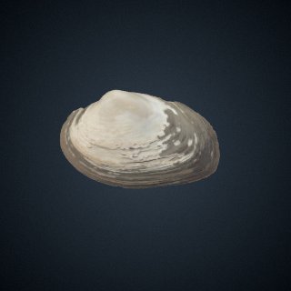
3D scan

Licence
CC0 — this site’s default, not the record’s
Commercial use
the licence allows it
Specimen
Parreysia rugosa

CT scan

Licence
not stated by the source
Commercial use
cannot be read from the licence given — check the record
Specimen
Dysommina rugosa · USNM:FISH:USNM 190541
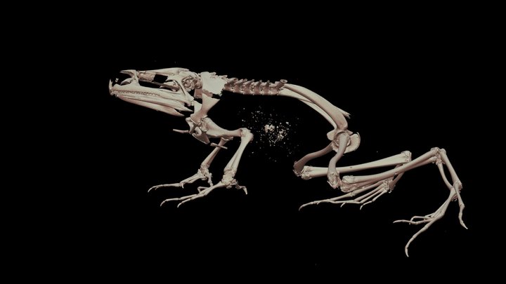
3D model

Source
Sketchfab
Licence
CC Attribution-NonCommercial-ShareAlike
Commercial use
the licence does not allow it

The description on this site

Licence
CC BY-SA 4.0

This is what the site found, which is not the same as what exists.

Keep going

Occurrence data from the Paleobiology Database, CC BY 4.0. (Milne-Edwards and Haime 1850)