Venericardia
Venericardia is a widely distributed genus of marine bivalve molluscs, in the family Carditidae.

H. Zell · CC BY-SA 3.0 · via Wikipedia/Commons. May be a photograph of a specimen, or an artist’s reconstruction — an interpretation of a skeleton, since colour and soft tissue are almost never preserved.
On record
Recorded, not inferred- Sits inside
- VenericardiinaePBDB
- Diet
- suspension feederPBDB, for Carditidae
- Life habit
- shallow infaunalPBDB
- Motility
- facultatively mobilePBDB, for Carditidae
- Vision
- blindPBDB, for Crassatelloidea
- Environment
- marinePBDB, for Crassatelloidea
Time the record covers
At least 184 million years on record.
The record covers at least 184.2 Mya to 129 ka. No occurrence read is dated outside 192.9 Mya to 11.7 ka.
1,656 occurrences of Venericardia on record, most of them in the Eocene. The Paleobiology Database records this as a living group. Bar height is expected occurrences, not a count: each fossil is spread across the span it is dated to, so a tall narrow bar means tight dating and a low wide one means loose.
When
1,656 occurrences- Early Jurassic2%
- Early Cretaceousunder 1%
- Late Cretaceous4%
- Paleocene24%
- Eocene56%
- Oligocene5%
- Miocene5%
- Pliocene1%
- Pleistocene2%
These are dates about fossils, not the animal: the record can only begin after it arose and end before it died out, so either end may reach further. Shares are expected occurrences: a fossil dated to a span is counted partly in each period it straddles. More on what this infers.
Found in
257 formations
- Moodys Branch Formation · Jackson Group84
- Hatchetigbee Bluff Formation · Wilcox Group73
- Kincaid Formation · Midway Group69
- Lisbon Formation · Claiborne Group57
- Cook Mountain Formation · Claiborne Group49
- Nanjemoy Formation · Pamunkey Group45
Loading coastlines…
The named rock units Venericardia has been recovered from, largest first. Drawn where the rock is now, not where it formed. 233 further formations hold fewer occurrences each and are not listed. 204 occurrences have no formation on record, which is common for older literature.
Venericardia and its relatives
EoceneWhere Venericardia and its relatives were recorded in the Eocene.
Found in the same rock
2,371 taxa- Turritella68 sites
- Dentalium50 sites
- Eburneopecten scintillatus50 sites
- Gastropoda47 sites
- Bivalvia45 sites
- Nuculana45 sites
- Cadulus44 sites
- Corbula densata38 sites
- Hipponix38 sites
- Calyptraea (Trochita) aperta37 sites
- Caestocorbula wailesiana36 sites
- Tellinidae36 sites
- Myrtaea (Myrtaea) curta35 sites
- Ostrea35 sites
- Pitar34 sites
- Ficus32 sites
- Bathytormus flexurus31 sites
- Nucula (Nucula) sphenopsis31 sites
- Pseudoliva vetusta31 sites
- Retusa galba31 sites
- Corbula30 sites
- Athleta petrosa29 sites
- Barbatia (Plagiarca) rhomboidella29 sites
- Bullata semen29 sites
The Paleobiology Database records 976 sites for Venericardia, and this reads 240 of them. Of that, one read hit the database's own return limit, so every count below is a floor rather than a total. The number is how many of those sites it was catalogued from too. The 24 sharing the most are listed.
This is not a list of everything alive at the time. It is only what has come out of the same ground as this animal and been written down.
Entered from
271 references- Catalogue of the Paleocene and Eocene mollusca of the southern and eastern United States. Part 1. Pelecypoda, Amphineura, Pteropoda, Scaphopoda and Cephalopoda143
- Stratigraphic Distribution of Paleocene and Eocene Fossils in the Eastern Gulf Coast Region136
- Resilience of marine invertebrate communities during the early Cenozoic hyperthermals82
- Molluscs at the K/Pg boundary in Argentina: Extinction and recovery patterns. unpublished Ph.D. thesis77
- Depositional dynamics and the record of ecosystem stability: early Eocene faunal gradients in the Pyrenean foreland, Spain60
- Impact of lithification on the diversity, size distribution, and recovery dynamics of marine invertebrate assemblages55
- Lower Eocene Faunal Units of Lousiana47
- Fossil assemblages of a marine transgressive sand, Moody''s Branch Formation (Upper Eocene), Louisiana and Mississippi37
- Environmental and biological controls on the diversity and ecology of Late Cretaceous through early Paleogene marine ecosystems in the US Gulf Coastal Plain36
- Ecological control of evolutionary rates in Paleocene - Eocene marine molluscs34
- Faunal stability and environmental change in the middle Eocene Gulf Coastal Plain (PhD Thesis, Harvard University)31
- The Midway Group of Texas23
Each of the 1,656 occurrences read was entered from one of these publications, ordered by how many each accounts for. This is not a search for papers mentioning the name. 259 further references are not listed. Entries link to doi.org where the Paleobiology Database holds an identifier, and to its own record where it does not. Relayed as the Paleobiology Database holds them, not checked against what they resolve to.
Media and terms
Media content2

Picture of Venericardia
- Source
- Wikipedia/Commons
- Credit
- H. Zell
- Licence
- CC BY-SA 3.0
- Commercial use
- the licence allows it
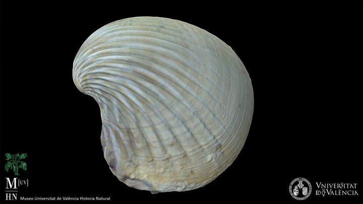
3D model
- Source
- Sketchfab
- Licence
- CC Attribution
- Commercial use
- cannot be read from the licence given — check the record
Smithsonian Open Access was not reached for this taxon, so this list is what the others held rather than everything there is.
The description on this site
- Licence
- CC BY-SA 4.0
This is what the site found, which is not the same as what exists.
Keep going
What may have been alongside itVenericardiinae through timeFormations of the EoceneThe world it lived on
Occurrence data from the Paleobiology Database, CC BY 4.0. (Lamarck 1801)